
Friday 26th May 2017 - CO/KS (Slight Risk)
An almost identical day to the 25th but the only difference today was the only player being Upslope Storms. We left relatively early to head towards the Denver area knowing that storms would be initiating by 2pm MDT we would be falling upon an already developed storm by the looks of it. We headed north from Limon on Highway 71 towards Last Chance and watched a few storms lined up in the distance in front of the Rockies. I finally picked a storm and the chase was on, and what a fun chase this was, probably my favourite of Tour 2!! And the fun began at the beginning of the chase as we used some not too normal roads and could have been mistaken for a scene in the film Twister! Rabbit is good Rabbit is wise bellowed over the radio a few times until we finally bumped back onto tarmac again from the tall grass field that was higher than the bonnet of the cars! Going X Country did allow us to keep up with a stunning rotating wall cloud though and always be in front of this Supercell who's structure was perfect for 100's of miles we chased. This storm tried so hard to put tornadoes down all the way from North of Limon all the way eastbound to North of Burlington (CO). Pic below
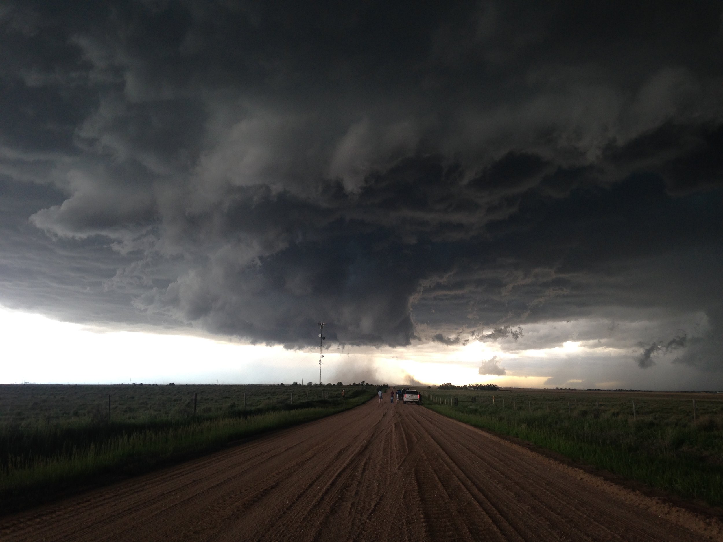 So this was turning into a Colorado Structure show instead as the low level shear was just not strong enough today. The structure kept coming and getting better as we neared Kansas.
 After crossing into Kansas dusk was starting to fall so we made sure to get some pictures near our old favourite stopping point in Kanorado along the rail tracks and it did not disappoint again! Thats 3 years on the trot now at that same place.
 Once it got dark we continued east towards Hays again where we had booked the hotel knowing we needed to get South and East for an expected big day in NE Oklahoma for Sat 27th which was already Moderate Risk! But along the way it always pays to look back especially when you are in the Nocturnal Tornado Hotbed that is Colby/Oakley/Grinnell and Grainfield! The amount of night-time tornadoes I have seen here is immense! And once again a few Tornadoes dropped and we are pretty sure we have 1 such on camera. SPC Reports page below!