
Saturday 17th June 2017 - Kansas (Enhanced Risk)
We awoke today in York with an Enhanced Risk of Severe Storms over a large portion of Missouri and Kansas and a 2% Tornado Risk. I liked the look of todays risk with an Outflow Boundary along the Flint Hills from Salina to Kansas City, in fact it was an almost carbon copy of the Chapman day last year synoptically. We had lunch in Beatrice and headed south to our chase target of Fort Riley (Ks) Risk Below Temperatures once again nearing 100f at Salina with mid 60's dewpoints were the only mitigating factor against stronger tornadoes, decent 40knt NW flow would once again promote SE Storm Motions, A cold front was to our west near Salina so the thing we were hoping for was a storm to initiate in this region and latch onto and ingest the Outflow Boundary. At about 4pm massive Towering Cumulus was getting more agitated and with 4000j of Cape things would be quite explosive today. And soon after 5pm we were chasing with a nice little Storm just east of Salina gaining 50,000ft in 25 minutes. We headed south and got our first look at a rapidly developing Supercell, the speed at which this went from LP to Classic was mind blowing, we literally went 10 miles down the road and it had transformed itself into the picture below with really fast rotation.
 Now I have seen this type of structure and fast rotation many times before and I even stated to the guests it was only a matter of time before this tried to put a tornado down, it had clearly hit the Outflow Boundary and was really trying hard to produce a tornado, the radar sequence was amazing to see as well with the OFB being eaten up as the storm progressed South East. Our road options to keep south took us South West for about 3 miles and through the town of White City, so we would have to slice right through the hook region of the storm, this can be a risky situation but when the RFB( Rain Free Base) is easy to see there is a lot less risk about it. As we went underneath and through the hook the rotation above the road was the fastest we had seen and the storm tried to put down a ghostly white tornado on the road in front of us, and still this storm was NOT Tornado Warned!
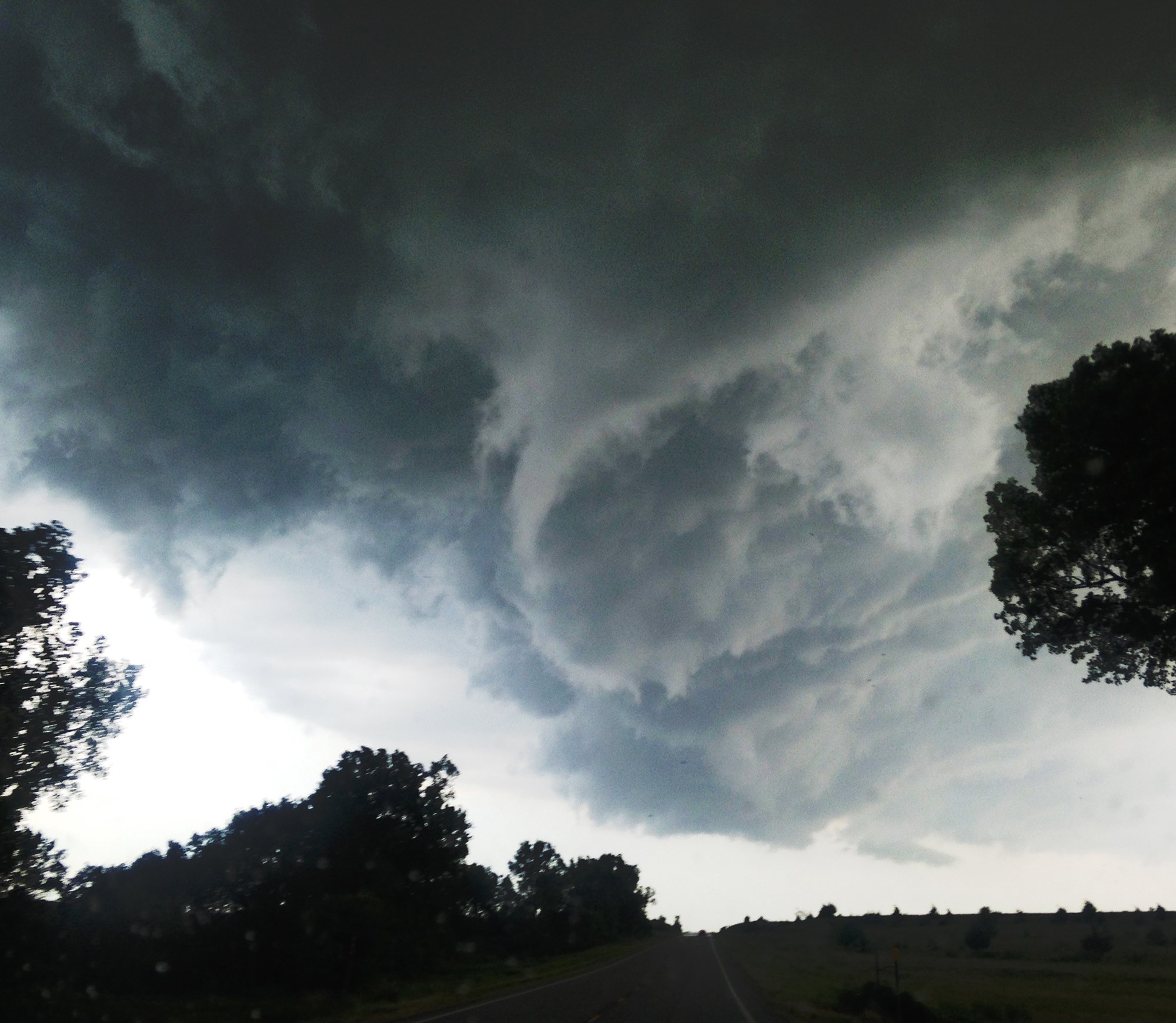 We later learned from Australian Chasers Jane Oneill that this did indeed touch down just to our east as they were 5 miles further east and there picture matches up with where we were! Success the first Tornado of Tour 4 in a lean period! We continued with this storm but as with most outlooks this year the storm grew upscale with other storms around it into an eastward moving system quite quickly! We continued south watching numerous storms initiate to the west and at the end of the day tried to get a direct impact near Emporia but the storm split and went around us, typical once again when you look for some fun core punches things never seen to go your way. Finished the day in Wichita and knowing there would be a down day tomorrow made plans to visit our Kansas Friends and watch a baseball match on Sunday before heading to Colby for the evening in readiness for some Astro Photography on Sunday Night!