Monday 14th May 2018 - CO/KS - Slight Risk
Awoke today in Limon and HRRR was showing a strong Supercell moving ESE down Interstate 70 on most of its morning runs. Decent dewpoints further east towards the Kansas border would sustain this storm well into evening and it looked like early initiation as well close to the I-25 Corridoor. What we did not expect was one of the longest track Supercells we have ever chased coming in at just over 300 miles in its lifespan. We picked the storm up just NE of Castle Rock and moved back east towards Limon, the Storm looked great early on with a nice wall cloud near Kiowa. We then stopped NW of Limon where the Supercell was taking on HP Structure with a shelf cloud hiding the Hail which was getting bigger with every scan of the radar sometimes topping out at Baseball sized.
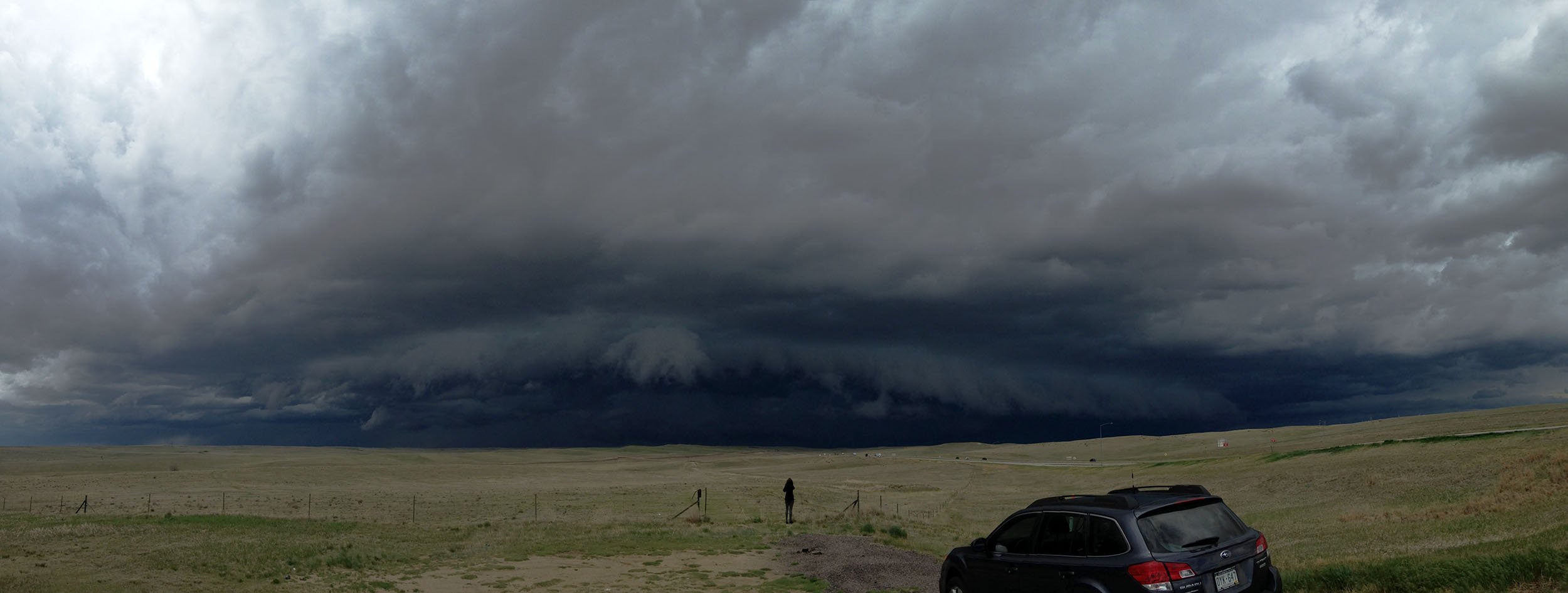
 We carried on east stopping at Arriba and Flagler and sampled our first hail, mainly quarters but some golfballs thrown in. After this we went south to Vona and stopped again to treat the guests to some hail, this time the hail was mainly baseballs and the wrap around precip caught us out for a few miles with Cars 2 and 3 sustaining major damage to windscreens, panels and bodywork.
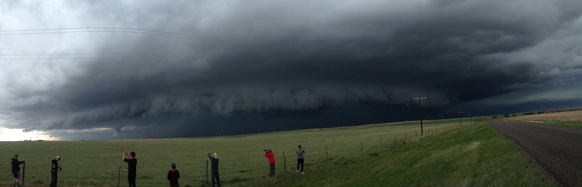
 We continued on batterer and bruised down towards Sharon Springs crossing into Kansas with the Supercell still going strong, some amazing structure was now starting to show as well.
 We finally let the storm go to our east when tummies started to rumble more than the thunder and stopped west of it before heading to Syracuse for dinner at the Black Bison Pub. An amazing opportunity to see this Supercell from the west.
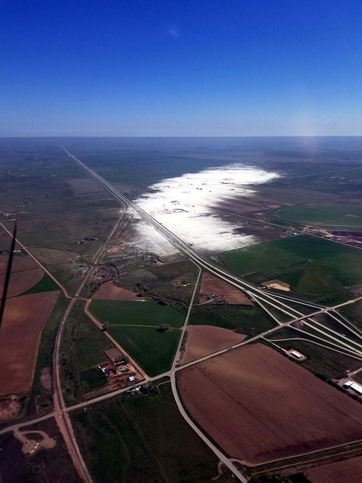
 A day later I found this stunning image of our storm taken a full 24 hours after it had reeked havoc across Colorado and Kansas and the hail swathe was still evident to see from the air. A truly incredible Supercell Storm