
Wednesday 23rd May 2018 - CO/NE - Slight Risk
Started today in Limon and trundled up Highway 71 to Fort Morgan for a lazy lunch at Cables. Was very confident initiation would occur in NE Colorado today so was not suckered up onto the first storm near Torrington moving into the Nebraska Panhandle and stuck with our target moving up towards Sterling. A few failed attempts at storms occured but finally one shot up and went severe warned in 4 radar scans, the chase was on finally. Our storm started to head North East so we went down some dirt roads and found some hail. Picture Below John Finney The storm was now starting to turn right to the east and near Chappell it really got its act together and was finally starting to look like a Supercell.
 Picture above Credit John FinneyWe followed the storm towards Lake McConaughty and just south of there jaw dropping structure was starting to form in front of us.Picture Below Credit John Finney
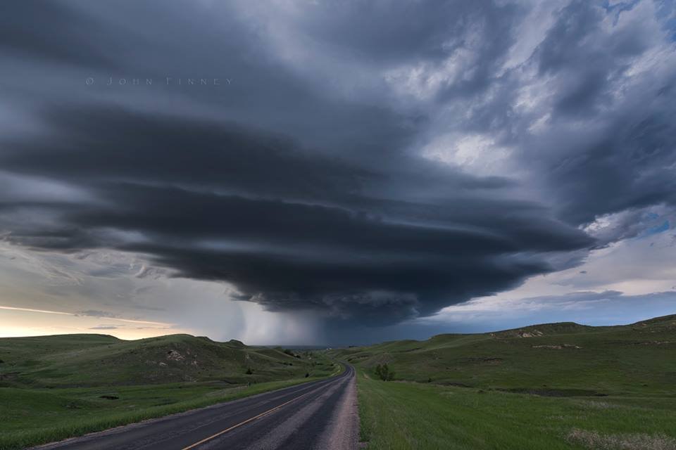 We then went east and North towards the Lake and Dam area and it was here that we really should have got in front of it again and not hung back for Lightning and Mammatus as the structure got even better further east. But where else can you finish the day with sand between your toes watching lightning overhead. And all of this in Nebraska.Picture Below Credit John Finney