Sunday 27th May 2018 - CO/NE - Slight Risk
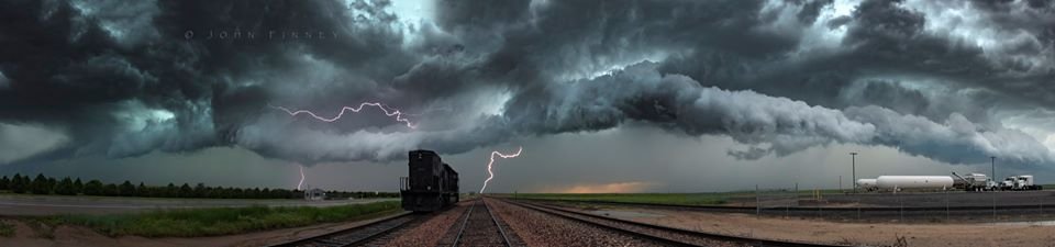
After our travel day to get into position from Elk City to Ogallalla yesterday we awoke finally to a 5% Tornado Risk with better upper support and some impressive moisture in place today would finally see the Season kick up a notch. My target upon waking up was La Grange to Cheyenne and we set off west along I-80. Around lunchtime and after looking at some Surface Obs for some reason I completely changed my mind and favoured NE Colorado, the 50f dewpoints near Cheyenne and NE surface winds were putting me off my initial target and SE winds and Mid 60's dewpoints looked nice just to my south, so I turned around.............Rule number 1 in storm chasing never change your target area or it will bite you on the arse.We got onto some nice Supercells all moving North but lacking anything to make them special, and as Models showed very messy in nature so why was I here still when the Storm of the day just 150 miles to my west was now tornado warned. The rest is History as they say, will post a screen grab of Paul Knightleys picture of Wyoming's Tornado of the year below.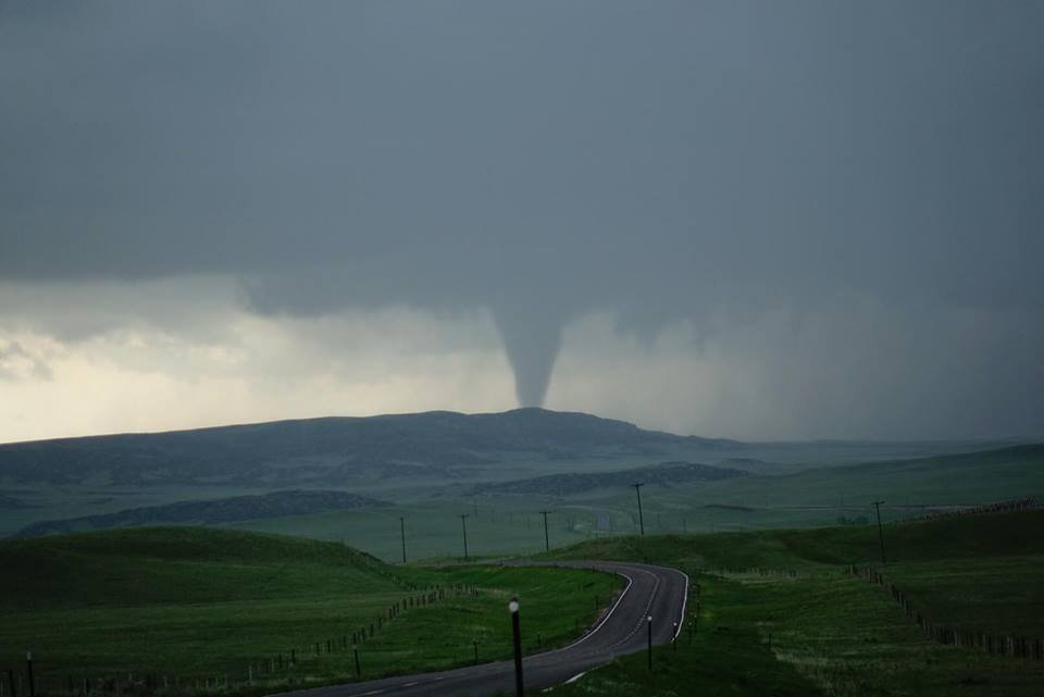 We stuck with our storms and core punched a few to try and get some hail dents but even that was sub standard. John Finney got a lovely shot below though and we ended the day again in Ogallalla. Tomorrow looks much better so lets hope Colorado produces some magic tomorrow on Memorial day,