
Saturday 16th June 2018 - SD/MIN - Enhanced Risk
We awoke today with another 10% Hatched Tornado Risk in the far NE of South Dakota and Western Minnesota. An Outflow Boundary would be the focus for storms today and with 84/76 T/Td spreads and ample shear it looked like a decent day. We got to the target area of Summit and waited until 7pm with tonnes of chasers in the Car Park of a Petrol Station.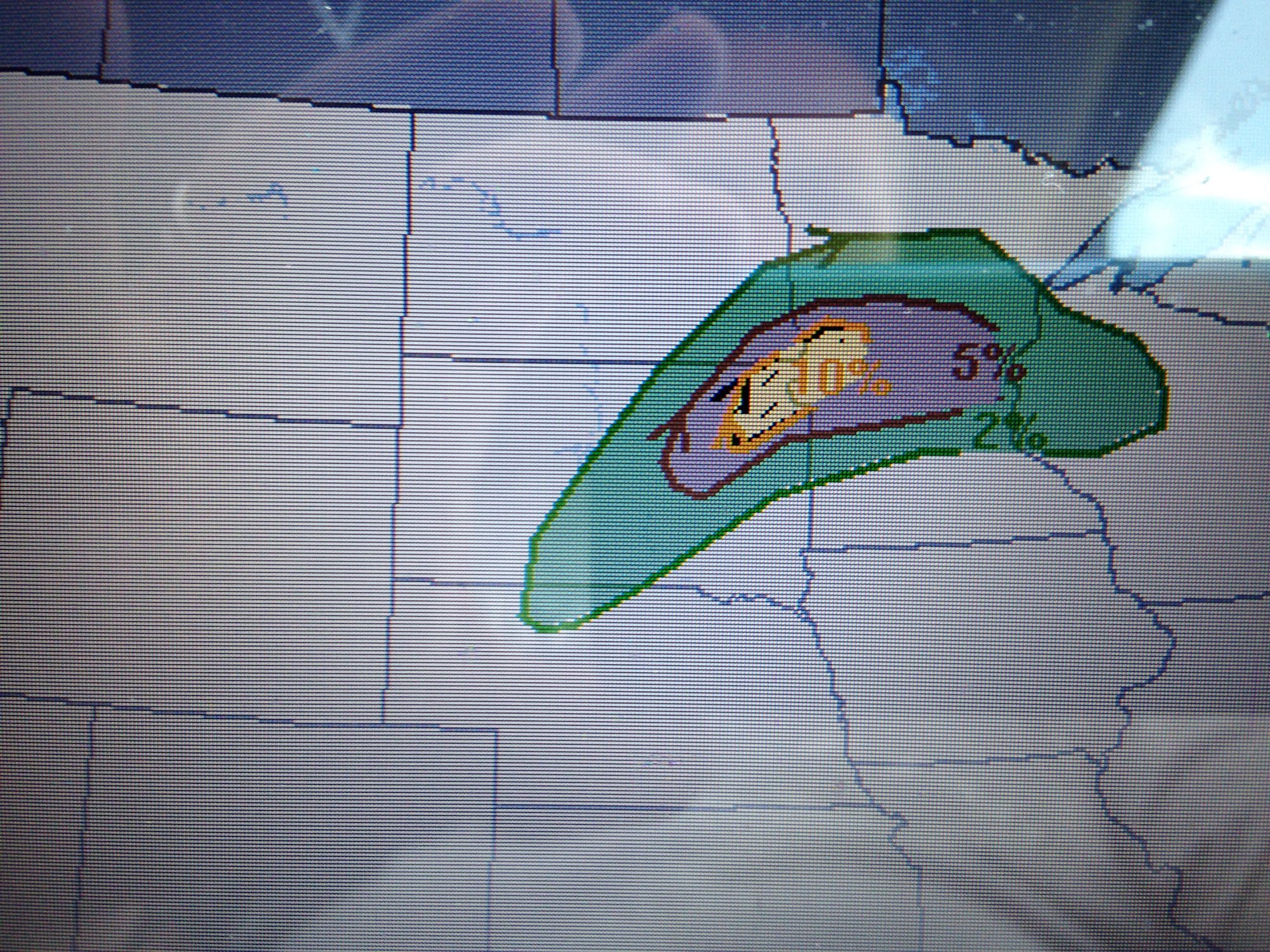 An elevated storm South West of Watertown soon became surface based and so we headed east to Ortonville in Minnesota to plot and intercept course.
 The Storm came towards us and we noted weak rotation and a small couplet to our South West, dangerous lightning was pounding our position. Small needle funnels were dancing around but we also noted lots of new convection going and up interfering with our storm.
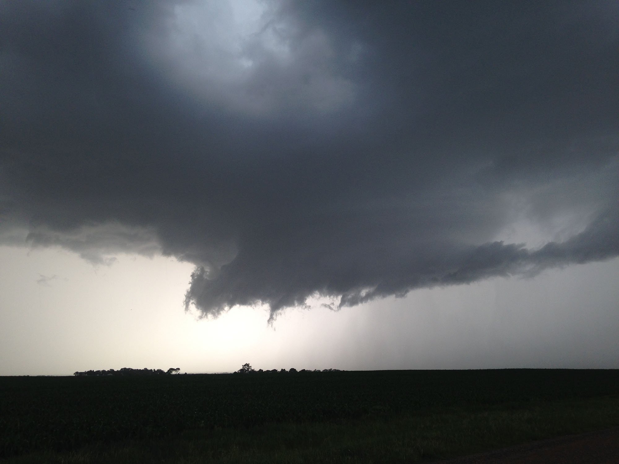 And that was pretty much it, the whole area of storms filled in and became a rainy mess, another day of amazing synoptics down the pan. We then headed west to more areas of storms and shot lightning from a hilltop. We ended the day in Watertown.