
Friday 22nd June 2018 - CO/KS - Enhanced Risk
Started today in Fort Morgan with a very broad 5% Tornado area and a massive Enhanced Risk that covered Colorado, Kansas, Oklahoma and Texas. Overnight Models were keen on very early initiation in 2 South-Eastward Moving Bands. The trick today would be to get onto something that was Supercellular before everything grew upscale from congealing coldpools. My Inital target was Lamar for around 3pm so we set off south for a quick lunch in Limon. Along the way and at 1030am a High Based Supercell had already gone Severe just to our West, we could not resist the opportunity to take a few snaps before continuing our journey South.Shot below from Mark Pritchard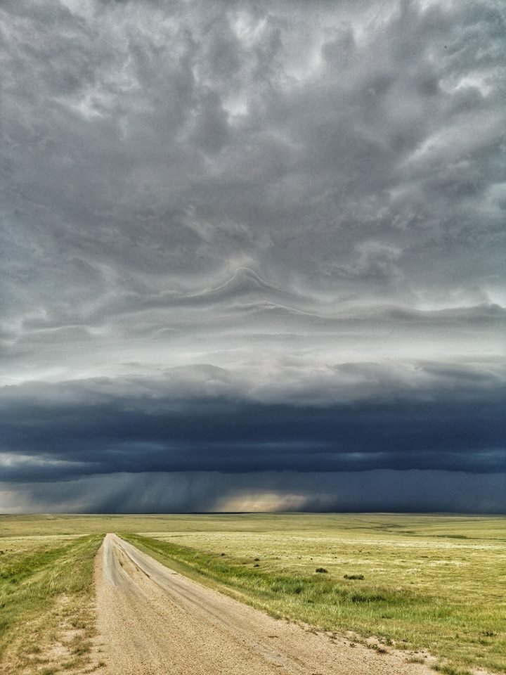 Even the Iphone Pano came out really well.
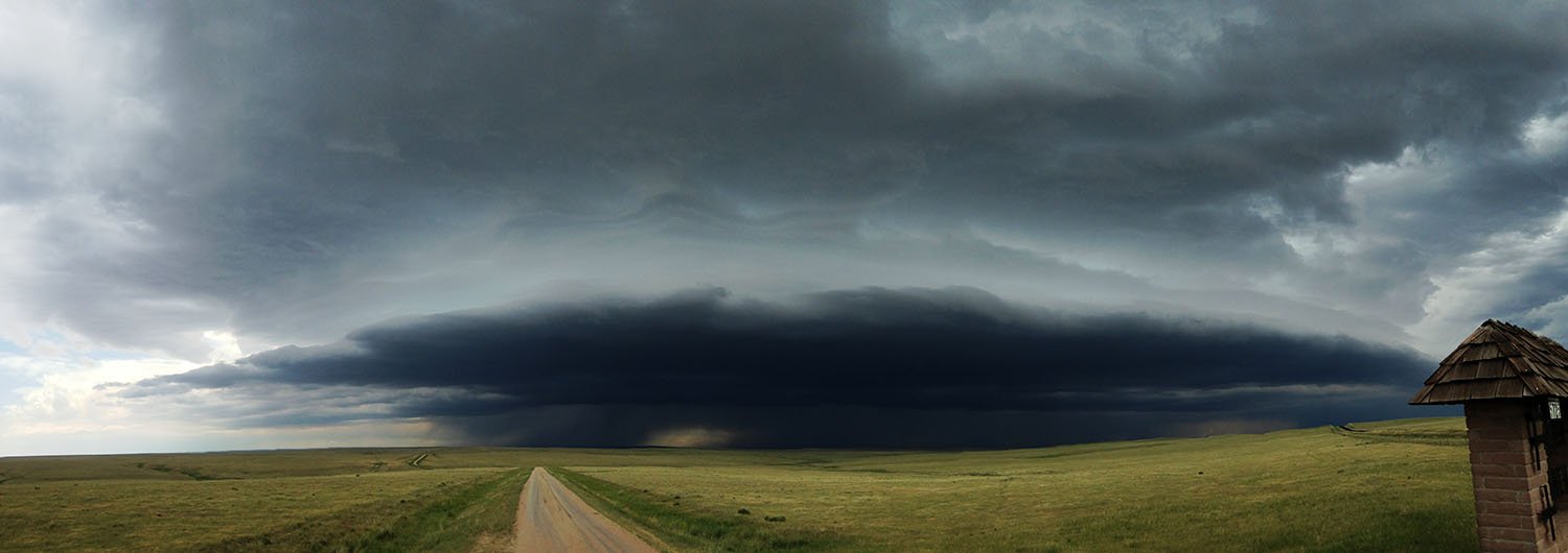 Our first Storm we intercepted was NE Of Pueblo, it briefly looked very nice but then took some time organising, we ploughed on and core punched a messy line of storms near Sheridan Lake. From there we turned South along Highway 385 to a Storm that was acting very strangely and had stalled near Bristol. The only way through was through the Hail Core and here we took some large Ping Pong and Tennis Ball sized Hail, we lost 1 windshield in the process. When we stopped South East of the Storm it really started to wrap up and insane fast rotation and rapid rising motion was noted to our North, this moved over us and the Storm started to form a hook, it wasnt long before it became Tornado Warned. How this storm did not produce a Tornado is beyond me.
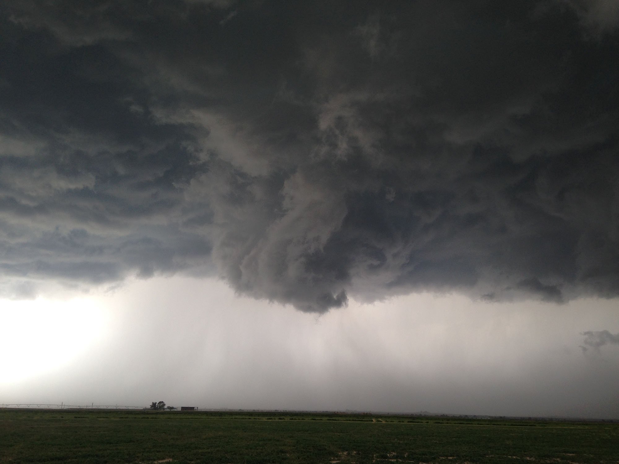 We continued East along dirt roads into Kansas and watched the Storm Cycle up and Down, West of Syracuse it once again gained strong rotation and the Wall Cloud was almost dragging the floor but once again it did not produce, I can only think weak inflow surface winds were stopping a bonafide Tornado producer today.
 Knowing this was the last day before Changeover in Denver tomorrow we had to sadly leave the Storms and head back towards Burlington for the night, the drive back was stunning though with the setting sun to our west and a sky full of Mammatus to our East. A great end to a great Tour 4.