
Thursday 2nd August 2018 - AZ (Marginal Risk)
Today looked really good with PW Values upto around 1.82 Inches and a Gravity Wave heading North from Sonora. High Res Convective Models were all showing the same thing impacting the Phoenix Metro area from 5-10pm so today would be a very local chase. After a nice lunch in Tempe we headed to South Mountain for some views of the Desert Floor and to kill some time. We then headed down towards Maricopa where just south of there a Severe Thunderstorm had been ongoing for about an hour. As we neared Interstate 8 warnings started coming though about a massive Haboob heading North and East and we could see the tell tale signs in front of the Storm. I opted to ride this one out and not travel back to Phoenix mainly due to safety issues as it was pretty much following Interstate 10 and there were some nice storms on the back side of the system which would be good for Sunset/Storm chances. As the Haboob approached Sacaton the scenes were apocolyptic.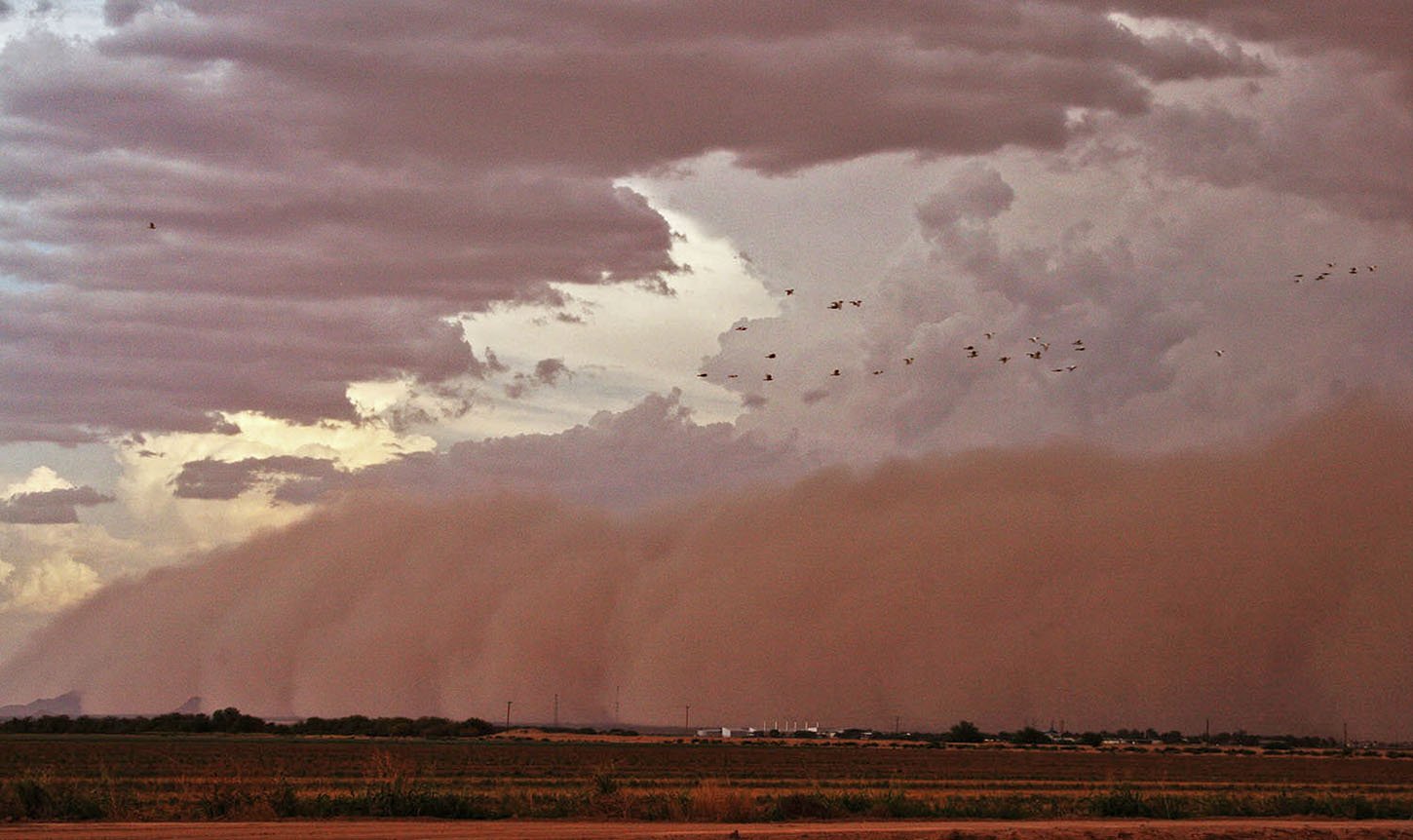 A 5,000ft High 70 mile wide wall of Dust racing North at 40-50mph which contained 60mph winds inside it. A truly spectacular sight and when it hit us we had zero visibility. Reports of accidents on the Interstate made me head east on small roads and wait for the dust to clear North. We were rewarded with a nice clear view of a storm which initiated on the outflow of the previous storm and gave us some lovely sunset storm shots to end the day.
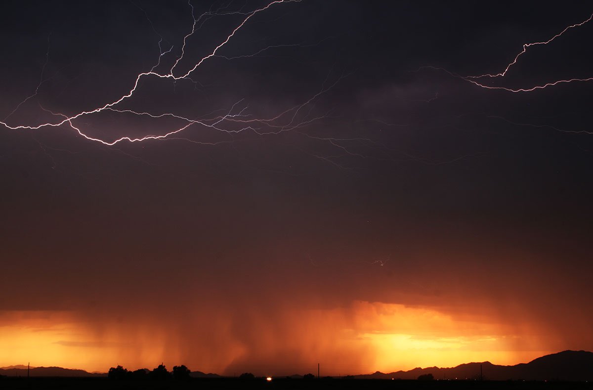
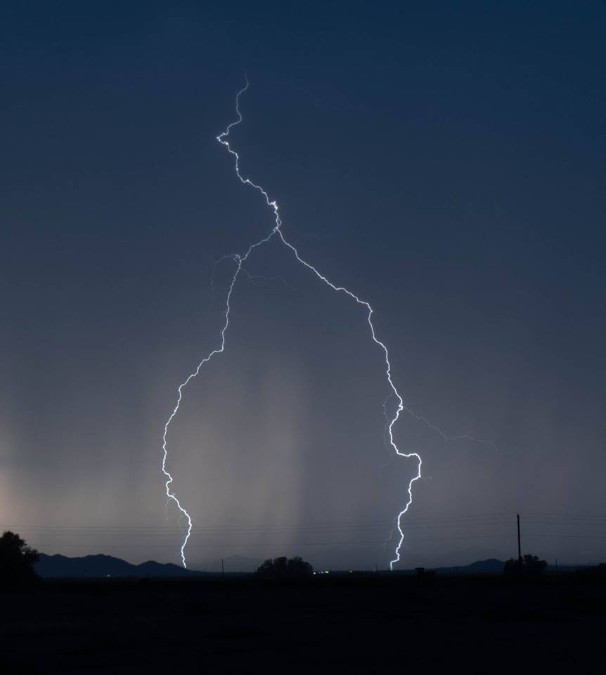
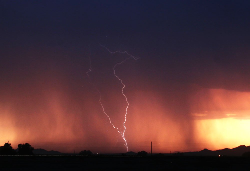 As it got darker Stuart got some nice pictures over the Mountains near the Maricopa Valley - Pics Below
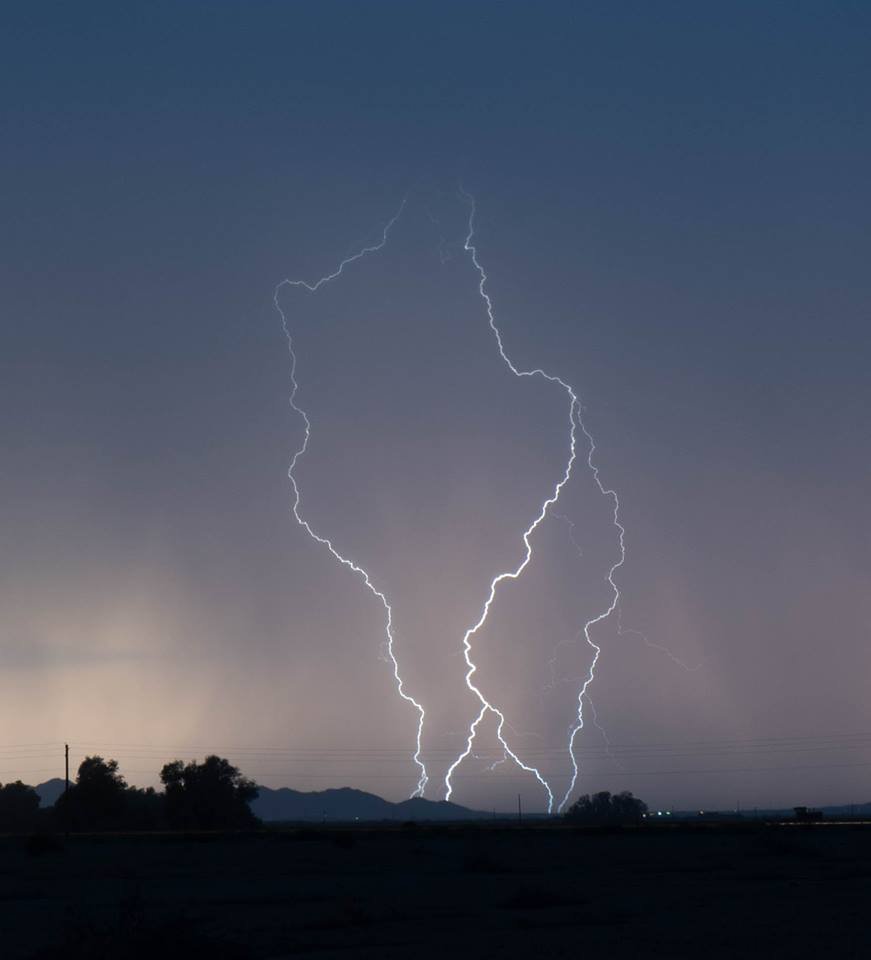
 Another really Solid Monsoon Chase Day for Weather Holidays