
Tuesday 13th August 2019 - Colorado (Enhanced Risk)
We started today in Dumas and left towards our target of Burlington (CO) for some Supercell action and along the way the SPC Upgraded the Risk area to Enhanced for 45% Hail and 5% for Tornadoes. This was a solid May/June Set-Up occurring in August. Great South Westerly flow at 45knts, a deepening area of Low Pressure and high 60's dewpoints into North East Colorado, this Set Up was screaming Tornado Potential. HRRR was showing Initiation around 3pm with South Eastward Moving Supercells which would eventually form into a Bow Echo which would race across Kansas so the trick was to get on Storms Early. After passing through Lamar we noted a Supercell already ongoing at 1130am near Ogallalla and what looked like a solid Storm firing up near Sterling. Storms were firing around 3 hours early so after arriving in Burlington to gas up we grabbed a quick lunch and headed North on Highway 385 and sat around 15 miles North of there watching the Storm of the Day gain a Tornado Warning and start to come into view. It had an amazing low base and we had screaming 40mph hot South East winds going into it.
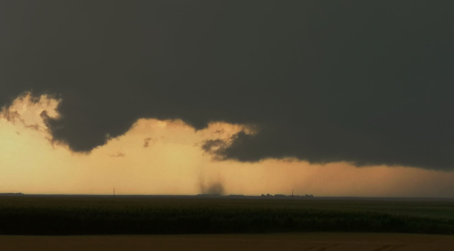
 And it wasnt long before a huge Cone Tornado had dropped to the ground near the Town of Joes (CO) our only problem was we could not get near to the Tornado from our vantage point due to lack of roads. Quickly another Tornado dropped down and we now had Twin Tornadoes ongoing.
 The Radar below shows our position looking at the Hook of the storm.
 We re-positioned further south towards Burlington to keep up with the storm and Tornado number 3 dropped much closer to us.
 More storms were starting to fire up at this time and it was starting to get messy already and this was happening at 4pm. A Storm to the South West of the Tornado producer near Bethune was dropping extreme hail and we later learned that the Colorado State Record Hailstone had gone with a 5" Stone being verified but NWS Goodland the next day.
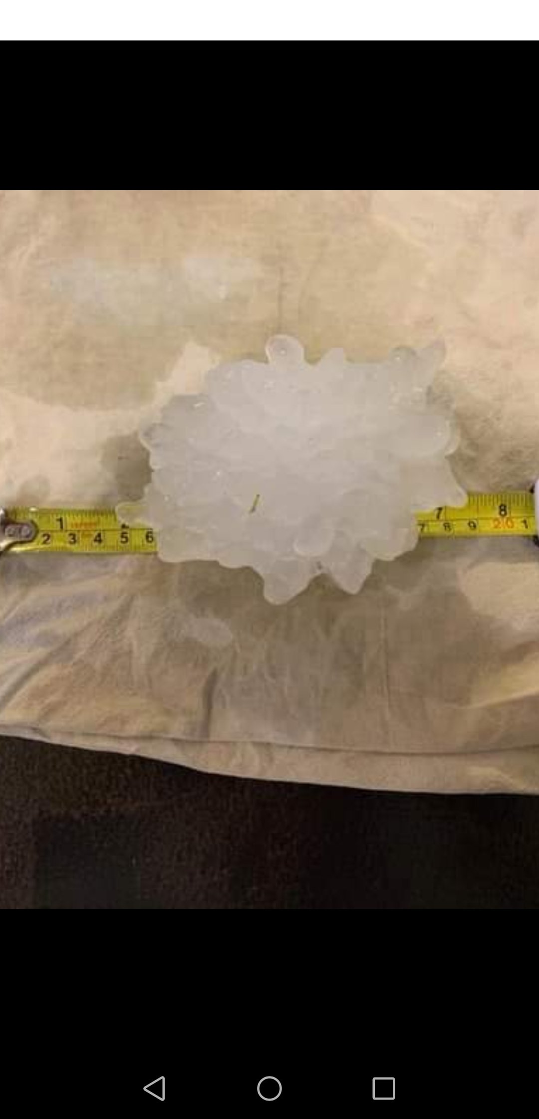 I decided the chase was pretty much over at this point as storms were going Outflow Dominant so decided to pick our way out of the mess and get south to shoot some pretty green skies over some Sunflower Fields we had seen earlier.
 We stopped west of the line of storms to shoot some lightning and ended the day in Burlington ready for another chase in exactly the same area for tomorrow.