Wednesday 11th May 2022 - SD & Minnesota (Enhanced Risk)
We started today in LaCrosse Wisconsin and had a firm target of just South of Sioux Falls. SPC went with a 10% Tornado Risk and put an enhanced risk up for the area bounded by NE Nebraska, NW Iowa, SE South Dakota and SW Minnesota. Todays set up was a lifting warm front transporting low 70s dewpoints north and an MCV moving North from SW Kansas, the models were showing an arc of Supercells erupting around the NE side of this MCV.What actually happened was very frustrating with numerous showers and outflow putting pay to anything discrete early in the day and a huge MCS moving ENE with Hurricane Force gusts on its leading edge. We tried to keep in front on this system heading east along I90 towards Albert lea but everything looked gusty and outflow dominant.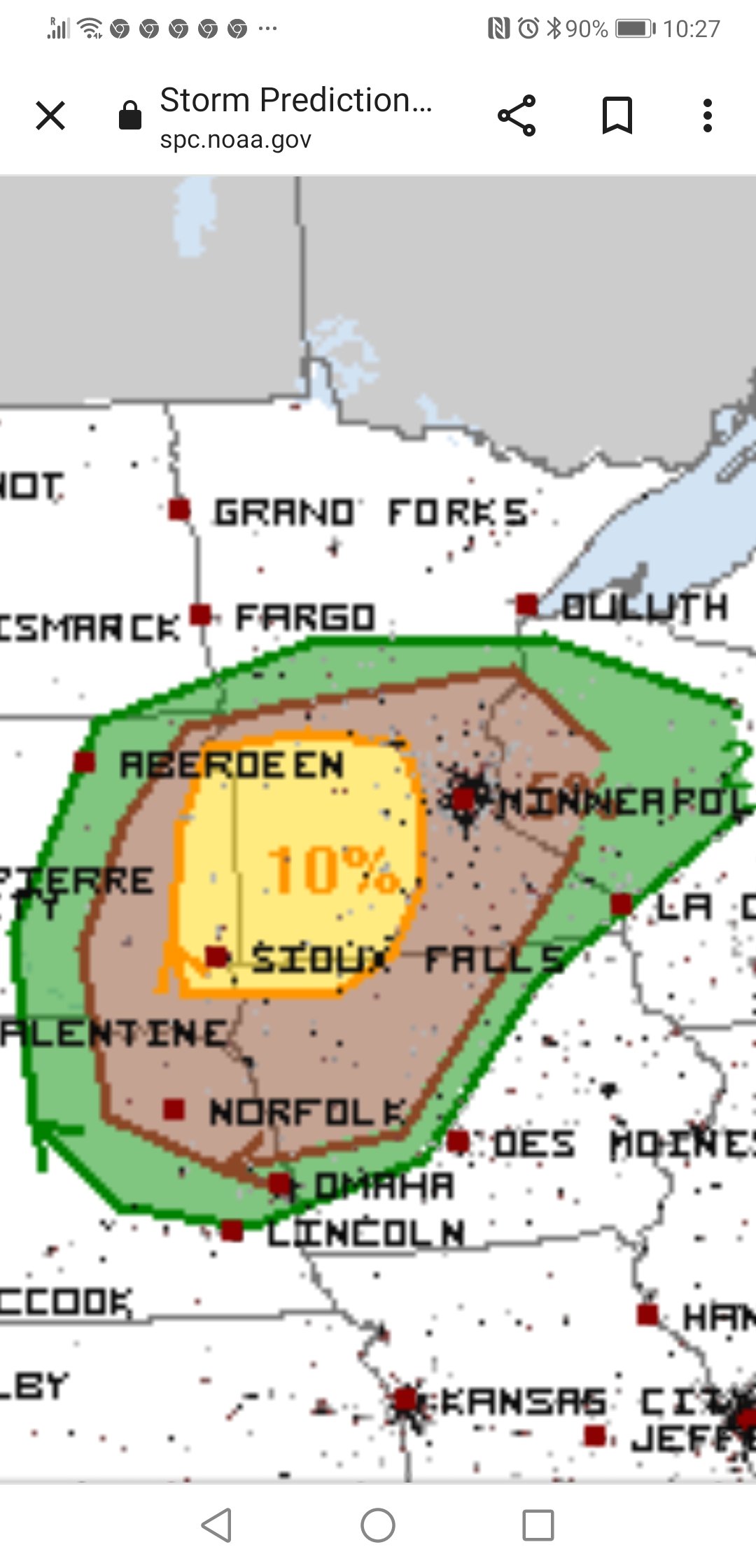
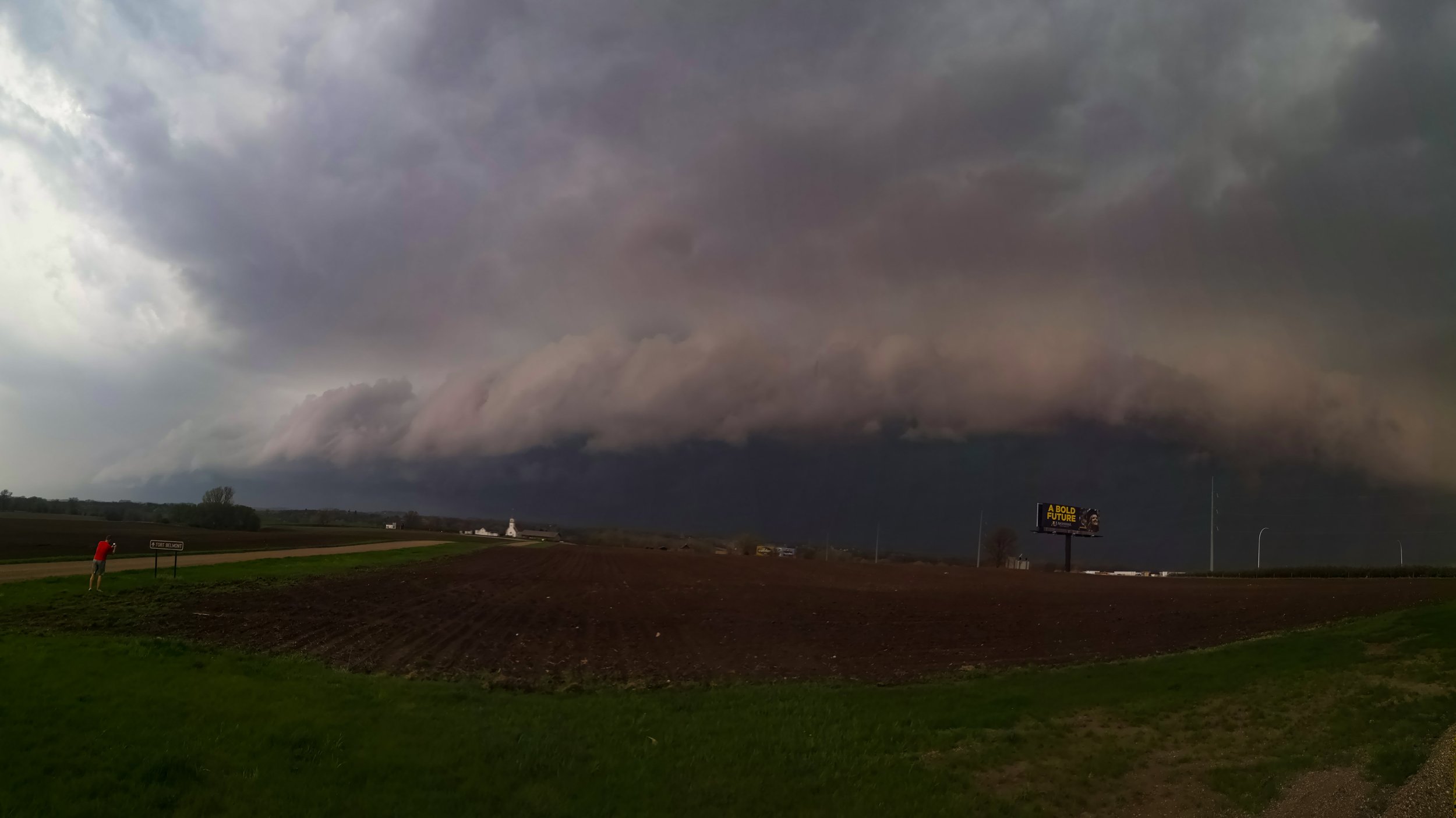
 Looking west at the Outflow Dominant part of the advancing MCS and Bow Echo